Project 02

WebMapping — Cinematic Establishments
JavaScript • PHP • OpenLayers • PostGIS • GeoServer • Apache
Interactive WebMapping Application
Interactive web mapping application developed in a 3/3 architecture (Client, Server, Database) to visualize and filter cinematic establishments in metropolitan France. University project carried out at Paul-Valéry University of Montpellier, M2 Geomatics 2024/2025.
JavaScript
OpenLayers
PHP
PostGIS
GeoServer
Apache
WMS/WFS
01 — 3/3 Architecture
The project is based on a classic three-tier architecture in webmapping: a spatial database, a map server, and a web client. Each layer communicates with the next to ensure dynamic and interactive rendering.
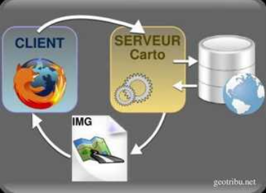
Fig. 1 — 3/3 Architecture: Database → Map Server → Web Client
🗄️
Database
PostgreSQL + PostGIS to store spatial data of cinemas and administrative boundaries.
🗺️
Map Server
GeoServer generates WMS and WFS feeds from PostGIS. Apache + PHP ensure the connection.
🌐
Web Client
HTML/CSS/JS page with OpenLayers for cartographic rendering.
⚠️ This application runs on localhost — GeoServer and Apache require a server. Complete source code available on Codeberg.
02 — Final Interface
The interface is divided into three blocks: search forms on the left, interactive OpenLayers map in the center, and the information panel on the right.
Fig. 2 — Interactive OpenLayers map with cinema points (local GeoJSON layer). Click on a point to see details.
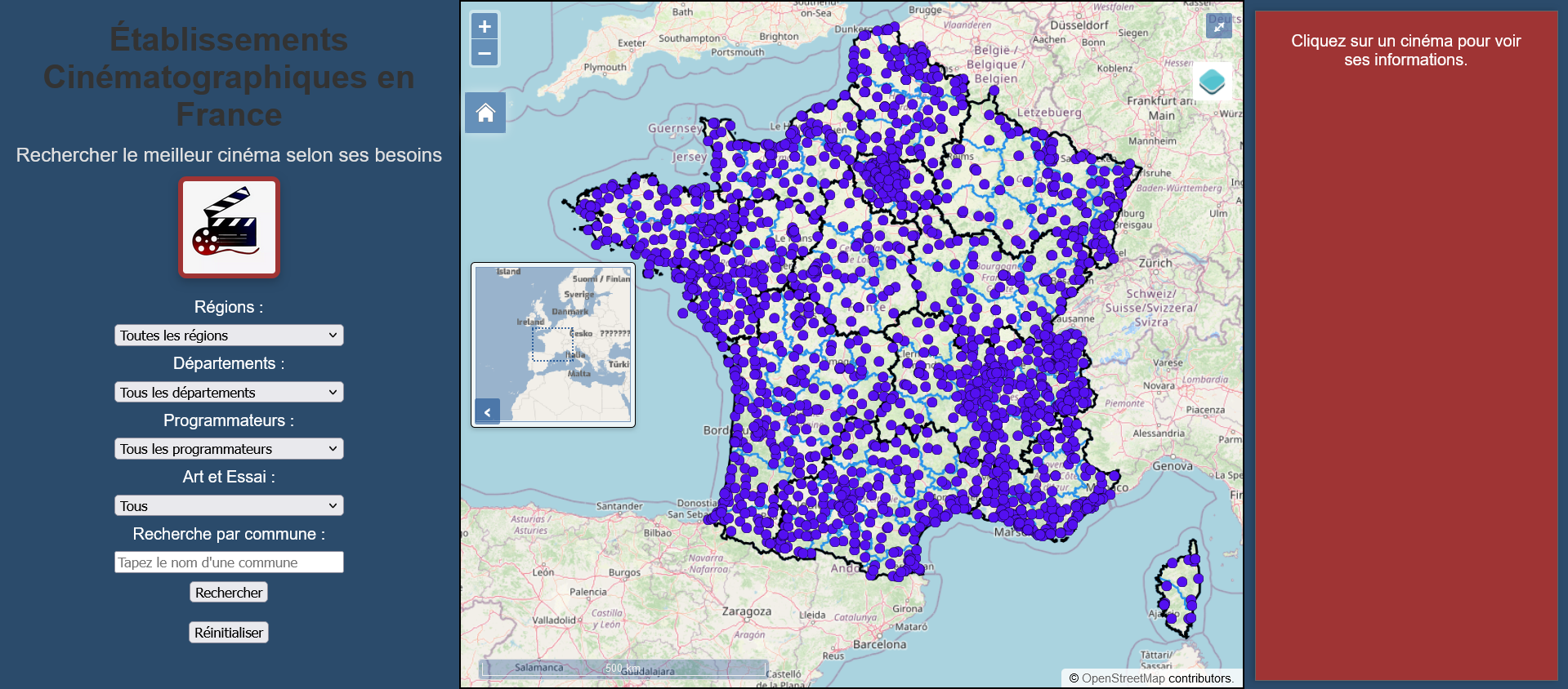
Fig. 3 — Final interface on localhost
03 — Dynamic Search Forms
The forms allow filtering cinemas according to several criteria simultaneously.
🗺️ Regions
Selection of a region with automatic zoom.
📍 Departments
Filter by department.
🎭 Art & Essay
Filter art & essay or commercial cinemas.
🏘️ Communes
Autocomplete for commune names.